Resting in the Woods: Exploring BC’s Bush Graves
Rich in history, from time immemorial, to coastal explorations, to gold rushes, and railroads, the vast wilderness of British Columbia holds many secrets. Beneath a landscape of trees, in the interior desert, and in the shadows of mountains and alongside rivers, lie the resting places of those who lived and died on the land.
With long distances between settlements, when people fell ill or otherwise perished from misadventure, they were buried on the spot. While the majority of these places are long-forgotten, the locations of some are still known.
The graves listed in this article are only those located on publicly-accessible land, and are described generally rather than precisely, out of respect for the sites and those associated with them. If you do choose to visit one of these sites:
- Be respectful.
- Do not disturb the area.
- Take only photos.
True Bush Graves
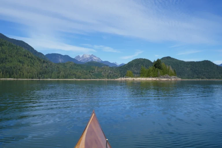
True bush graves are those outside of parks or other protected areas, on Crown land that remains largely undeveloped and publicly accessible. If you choose to go exploring and try to find one of these, remember to be prepared when venturing off-trail and into the backcountry. Leave a trip plan, have reliable navigation, and bring your ten essentials and other relevant gear.
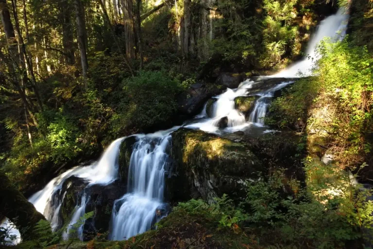
Michael Brown (Depot Creek, Chilliwack Lake)
Michael Brown, born in Galway, Ireland, was a Private in the US Army, serving as an escort for the International Boundary Commission. On October 10, 1858, at 26 years old, he drowned in Chilliwack Lake after his canoe tipped over. His body was found the following June and buried near the mouth of Depot Creek. While first marked with a wooden cross, this was later replaced with a headstone in 1936.
More information on its location can be found in the book How Deep is the Lake? by Shelley O’Callaghan.
Simon Gunanoot (Stewart)
Simon Gunanoot, a member of the Gitxsan Nation, was accused of shooting and killing two men near Hazleton in 1906. He fled into the wilderness with his family, where they lived for 13 years before he surrendered himself to the authorities. After going on trial, he was acquitted of the crime. After dying of illness in 1933, at his request, he was buried at the same place that his father was buried, on Graveyard Point, on the shore of Bowser Lake. The burial site is a protected historical place, widely documented in historical accounts and maps, and located in an extremely remote area.
Hugh Gillis (Fort St. James)
During the Omineca Gold Rush, Hugh Gillis, like many other men, left his Prince Edward Island home to seek his fortune, promising his fiancée that he would return. After striking it rich, he left his Manson Creek claim in 1872 and was said to be travelling home with his gold. While on the trail, he met a pack train from Fort St James carrying the mail, which contained a letter from his beloved. After reading that his bride had married another man, he pulled out his gun and took his own life. He was buried there along the Baldy Trail; the spot was marked with stones.
John Carter (Carter Bay, Finlayson Channel)
Born in Surrey, UK, 24-year-old Able Seaman John Carter was serving on Captain Vancouver’s vessel, the HMS Discovery, which was on an expedition to survey the west coast. He was out with a small boat party that was exploring and surveying the coastline when the men got sick from eating mussels infected with red tide. While most of the men drank warm salt water to induce vomiting and survived, Carter either could not or would not, and perished early in the afternoon on June 16,1793. The nearest suitable burial site was named Carter Bay after him, and the place they’d gathered the mussels from was named Poison Cove.
Accessible Isolated Burials
Some isolated burials, while outside of cemeteries, have over time become landmarks, historic sites, or incorporated into parks. These sites are easily accessible, and much information is available about their history.
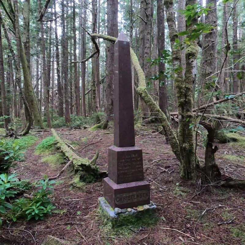
Danish Settlement (Cape Scott Provincial Park)
Cape Scott Provincial Park was once home to a Danish settlement, carved out of the rugged wilderness on the wild west coast. Remnants can be seen along the Cape Scott Trail, including the grave of William Christensen, aged twelve, marked by a large monolith. Nearby, on the opposite side of the trail, a short path leads to several more graves, buried in the underbrush. Archival photos also show a grave on the neck of sand near Guise Bay, but no information could be found online about it.
John Ray (Wells Gray Provincial Park)
Located in Wells Gray Provincial Park, the Ray Farm was once the homestead of John and Alice Ray. John Ray settled there in 1911 as a trapper and in 1933 married the daughter of another nearby pioneer family. They had three children, and in 1947, left the homestead so that their kids could have a better education. When John Ray returned that autumn, he died of a heart attack. He was buried on the farm, with the grave surrounded by a white picket fence. After his wife’s passing in 1959, her ashes were scattered there, and a headstone marks their resting place.
Trails around the area make the Ray Farm an interesting place to visit, with remnants of the farm visible and a mineral spring nearby.
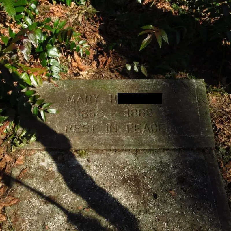
Charles Morgan Blessing (Quesnel)
Known as Blessing’s Grave, this burial site is located on a hillside off Highway 26 to Barkerville, formerly known as the Cariboo Road. Charles Blessing was a gold miner from Ohio who travelled to the area during the gold rush to seek his fortune. On May 31, 1866, while on the way to the gold fields, he was murdered by his travelling companion. Now a historic site, the grave is accessible by a short walk uphill from a parking area off the highway and is surrounded by a white fence and a wooden marker.
Rembler Paul (Kelowna)
Paul’s Tomb was built by Rembler Paul, who had a summer house in the area. Born in Montreal in 1831, he apprenticed as a printer, then headed west working as a prospector, miner, and trapper. Eventually, he married and settled in Regina, Saskatchewan, but he and his wife moved to Kelowna in 1905. The tomb was built by him in 1910, and his wife was interred there after she passed away in 1914. Paul was also laid to rest there when he died two years later.
Now located within Knox Mountain Park, Paul’s Tomb is easily accessible via a hiking trail. Most of the tomb is now buried underground to deter vandals.
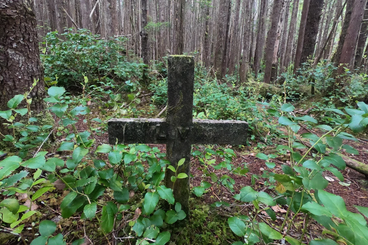
Mystery Graves and Animal Graves
While most isolated graves have been lost to time, some survive in photographs. While these capture that indeed a resting place was there, they often come with little information or context.
Grave on Mt Revelstoke
While searching for information on historic isolated burials, I came across a photograph of a grave on Mount Revelstoke, dated 1915. No further information could be found as to who it belonged to or where it is currently located, so for now it remains an intriguing mystery.
Finlay River, Sifton Pass Grave
An archival photo showed an isolated grave in the Sifton Pass, along the Finlay River, taken by the Bedaux Expedition in 1934. The caption states that it was the grave of a Klondiker. No further information could be found.
Samuel Black (Monte Creek)
After fur trader Samuel Black was murdered in February of 1841, the decision was made to transport his body to the HBC cemetery at Fort Vancouver, Washington. While navigating the steep Brigade Trail along Monte Creek, his coffin fell off the wagon and broke apart. While its current location is unknown, it is said that he was buried in the area.
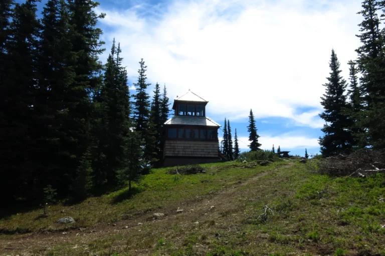
Pasayten Pete (Monument 83, Holdover Peak)
Located near fire lookout towers on the border of Canada and the USA, a grave marked Pasayten Pete has long been a mystery, with its marker reading: “Shot by L.E. Lael, 26-8-61.” Was he a mysterious wild man or simply local tomfoolery? As it turns out, neither. Pete was a mule who met with an unfortunate accident that ended with his being put down.
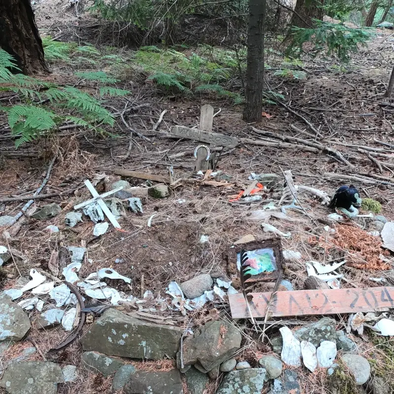
Will the Horse (Jedediah Island)
Jedediah Island was the site of a homestead belonging to Al and Mary Palmer. In the 1990s, after it was sold and became a Provincial Park, they left their livestock behind when they departed. Will the horse was one such animal, living on the island until his death in 2003. His grave, along one of the main trails, is marked by stones and trinkets. Herds of feral sheep and goats still roam the island today.
Plane Crash Graves
When planes crashed in difficult-to-access wilderness areas, the dead were often buried on site. Details about these sites and how to visit them respectfully can be found in my Lost Flights article.
A Note on Indigenous Burials
All Indigenous human remains are protected in British Columbia and are considered culturally sacred. Historically, Indigenous burials have been looted for artifacts, had remains stolen, or outright destroyed.
Indigenous burial practices varied by region and tradition. On the coast, the dead were placed in cedar boxes and rowed out to burial islands, placed in trees, at the top of mortuary poles, or in burial caves along the west coast. In the interior, the dead were sometimes buried in mounds.
In coastal areas of the province, paddlers will sometimes come across human remains in remote areas. Unfortunately, there have been cases where uninformed visitors removed human bones from burial caves and turned them over to authorities. Though they weren’t acting maliciously, actions like these can still cause harm.
Well-documented historic burials associated with nationally significant figures are treated here as history rather than locations; undisclosed Indigenous burial sites are not described or located. If you do encounter one of these sites, do not touch or disturb it, and do not share the location.