From Burnaby to Keremeos: BC’s Forgotten Centennial Trail
Once envisioned as a walking path stretching across British Columbia, the Centennial Trail was an ambitious idea born in the early 1960s, when outdoor recreation was gaining popularity. Spearheaded by the Canadian Youth Hostels Association, the aim was to create a path that would appeal to all outdoor enthusiasts, with different sections catering to hiking, biking, and horseback riding. Today, it remains a largely forgotten legacy, though the trail itself still exists.
At first, the plan was to create a 240 kilometre trail from the Fraser Valley to Merritt, which would later be pushed across the province to the Alberta border. Youth hostels would be built along the way. Later on there were tentative plans to make a second trail from Squamish to the Chilcotin through the Coast Mountains and back via Lillooet and Harrison Lake, though these routes never materialized.
The proposed route was up the Coquihalla Pass, mainly because the area was away from highways. Ironically, the Coquihalla Highway was built along this very corridor in 1986. It would follow the route of a 1854 Hudson’s Bay Company brigade. Though at first enthusiastic about the route, alternatives were also explored, and by the end of 1965 a route up the Chilliwack River linking up with Manning Park was also floated. Towards the end of 1965, the southern route was decided upon as it was more scenic and had less snowfall.
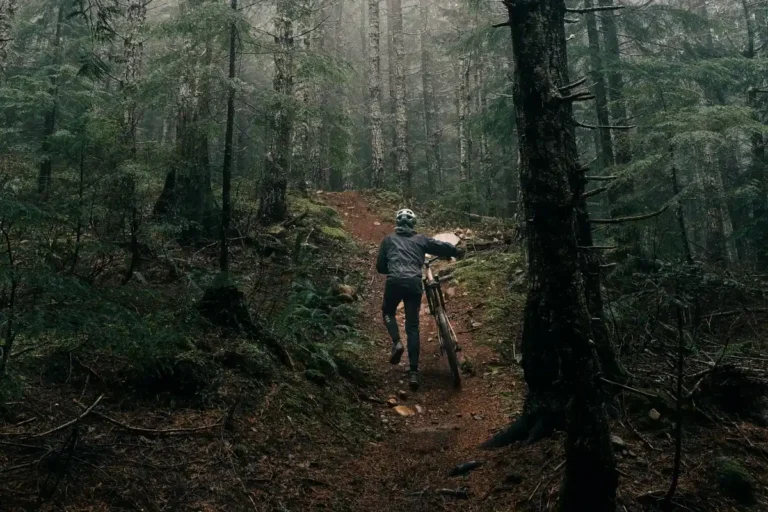
From Fort Langley, the route would follow an old telegraph trail to Matsqui, where the hiking portion would begin. After going up and over Sumas Mountain, it would follow the Vedder Canal to Vedder Mountain, follow an old logging road, pick up the Liumchen Trail at Cultus Lake, and head up the Chilliwack River. Following an old engineers’ road to Chilliwack Lake, it would then head up to Lindeman and Greendrop Lakes and over to Silver Skagit Road. After following the road for awhile, it would then link up with the Skyline II trail in Manning Park, which would take it to the lodge there. All told, the trail would be close to 200 kilometres long.
Options were also being explored to link the trail to Osoyoos. One possibility was to link up sections of the Old Dewdney Trail from Hope to Osoyoos. Another was to follow an old fur trade brigade trail to Princeton.
Though the project was spearheaded by the Canadian Youth Hostels Association, it was truly a collaborative project. Groups that helped to support the project included the North Shore Hikers, outdoor clubs at UBC and SFU, the Alpine Club of Canada, the Boy Scouts, the Vancouver Foundation, Chilliwack Mountain Rescue, the BC Mountaineering Club, as well as the provincial government, federal government, and military engineers from CFB Chilliwack. With the formation of the BC Centennial Trail Committee, donations and grants were secured, and work began in 1966 with army engineers marking and clearing a rough route.
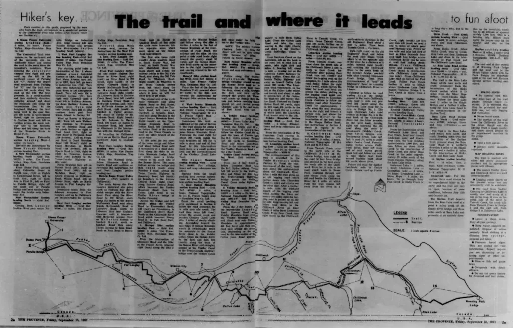
Work continued through 1966 and 1967, with the trail officially opening in a ceremony at SFU in September. By then the route included a series of roadways and dykes from SFU to Fort Langley, with this portion intending to cater mainly to bikes and horses.
At this point, newspaper coverage of the Centennial Trail dwindles, but from a scattering of later stories we can piece together further developments. In 1971, a section of unfinished trail was completed along Silver Skagit Road, and there were plans to take the trail to Keremeos via the newly established Cathedral Lakes Provincial Park.
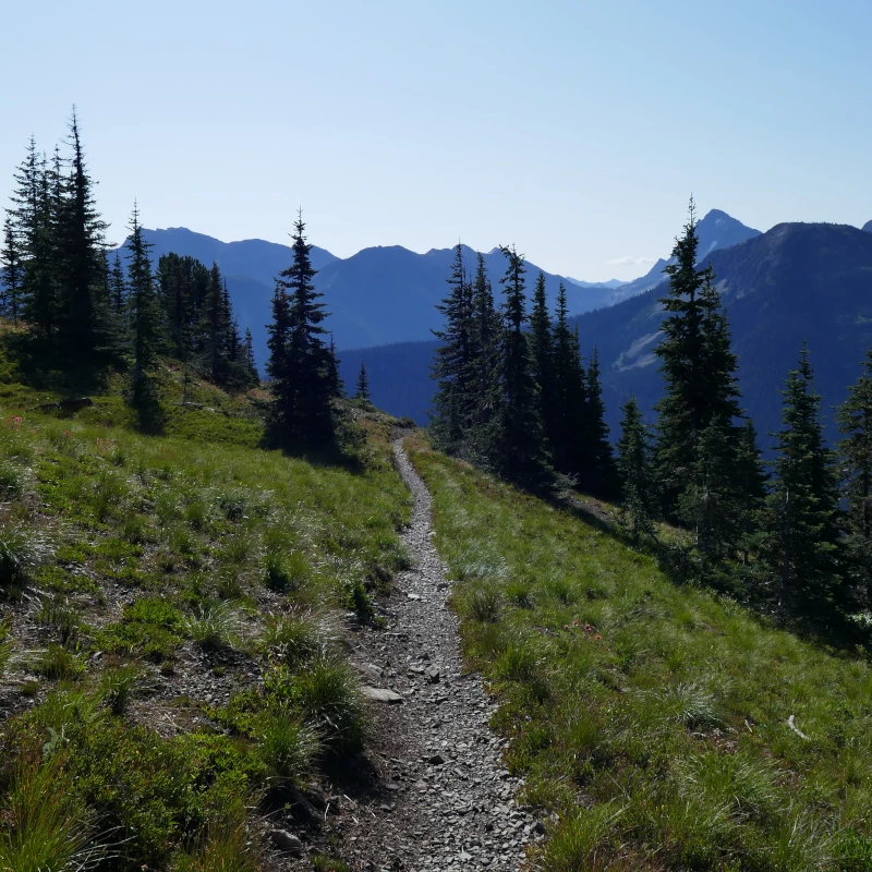
Eventually a section between the Manning Park lodge and Cathedral Provincial Park was included. This section used the Monument 83 Trail and the Cathedral Lakes Trail through the Pasayten River area to Trapper Lake. From there, a series of trails and roads connects to the Cathedral Lakes area.
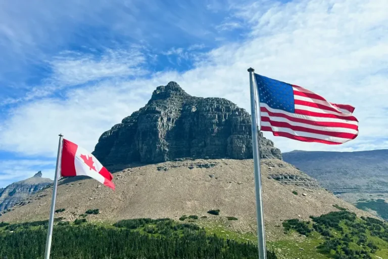
By 1992, the idea of a trail running across Canada was in the works, organized by the Calgary-based Trans-Canada Trail Foundation. A group called the Centennial Trails Trust was in charge of stitching together the Victoria to Banff portion, using portions of the original Centennial Trail. The idea of a multi-use trail across the country eventually came to fruition as the Trans-Canada Trail.
By 2001, the Trans Canada Trail followed parts of the Centennial Trail from Matsqui Dyke to Chilliwack Lake and continued via Lindeman and Greendrop Lakes to Silver Skagit Road. Today, the official route has shifted, bypassing Sumas Mountain and following roads from Chilliwack Lake through to Hope. The more remote sections from Manning Park to Cathedral Lakes were never included.
Unfortunately, the Trans-Canada Trail’s route through BC being largely along roadways with few trail portions is a major factor driving disinterest in the trail. Most outdoor enthusiasts find the idea of embarking on a road-based trek unappealing. From a legal standpoint, on the other hand, it’s understandable that recommending routes on deteriorated or poorly-maintained trails may pose liability issues.
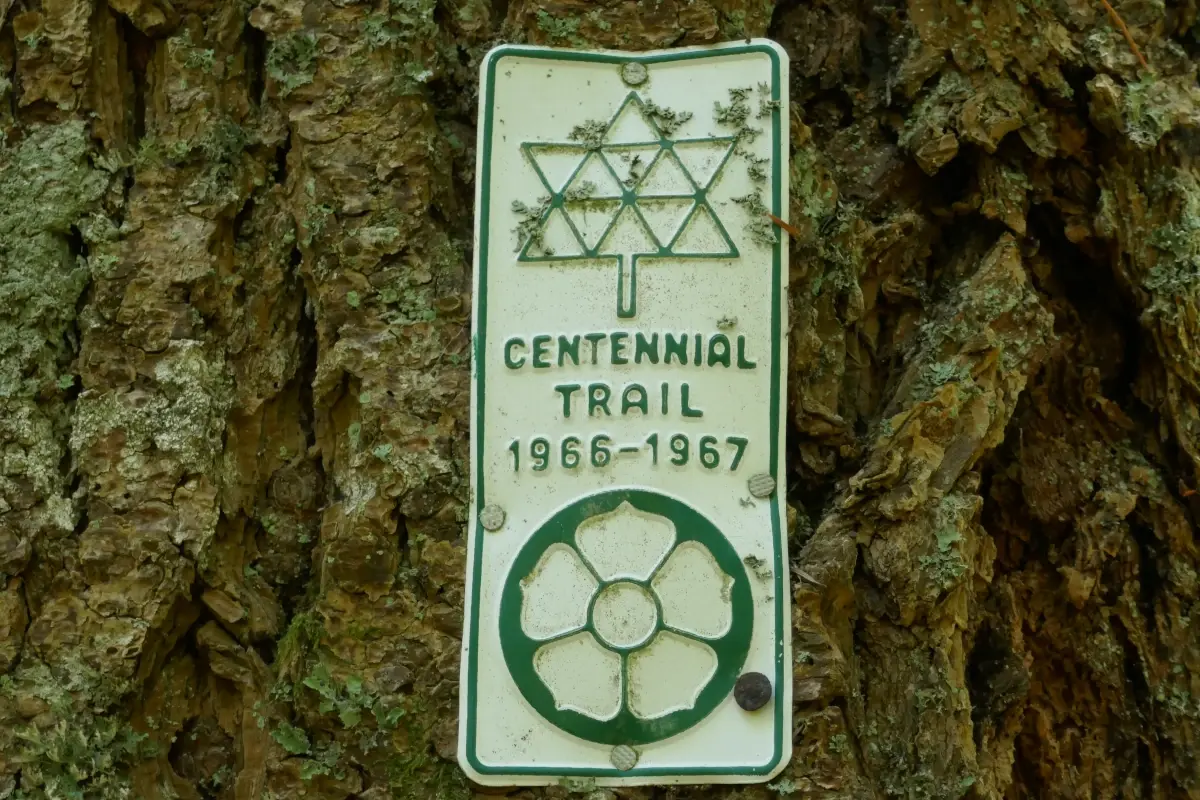
The Centennial Trail intended to follow trails for its entire route to the Alberta border, but these plans ultimately did not come to fruition either. The long term problem with the trail, as with many trails, was maintenance. It’s no easy task to maintain nearly 200 kilometres of backcountry path, and vandalism of trail markers made trail entrances difficult to find. Though nearly 5,000 metal plates were put up to mark the trail, they were often stolen and used as target practice. Information about the trail was also difficult to access.
Trails today face many of the same problems, with maintenance being a significant one. Though some areas have an abundance of volunteers, other areas wind up severely neglected—especially wilderness areas. The bottom line is that our province has more trails than volunteers to maintain them. Taking on maintenance in an official capacity is also difficult due to government red tape.
In recent years, the Centennial Trail has been restored in many areas. In 2021 and 2022, the BC Mountain Foundation and Friends of Manning Park received over $58,000 in funding to restore the Cathedral Lakes portion of the trail from Monument 83 to Trapper Lake. This included building a new campsite. Unfortunately, parts of the trail—including the new campsite—were subsequently burned in wildfires in 2023 and 2024. On Sumas Mountain, a portion of trail was recently restored from Chadsey Lake and a new route was established down the eastern flank of the mountain as an alternative to the steep Baker’s Grind.
With these improvements, portions of the original Centennial Trail have been revived. The trail itself is largely intact, though the routes from Greendrop Lake through the Skagit area are likely in poor condition. There is still much damage within Manning Park due to recent wildfires, and bridges along the Monument 83 Trail are still out from 2021 floods. Though more work is still to be done if the route is ever to be promoted as a viable multi-day backpacking route, the Centennial Trail could see a revival yet.
To help support the restoration of the Centennial Trail and other trails in the area, consider donating to:
- Friends of Manning Park
- BC Mountain Foundation
- Fraser Valley Mountain Bike Association
- The Trans-Canada Trail
- TrailsBC
Check out our Trail Talk page for more stories about BC’s trails!