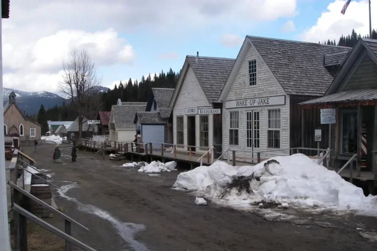
Lost Flights: Historical Plane Crash Hikes in BC
Those who love a good historical hike will find that there are many accessible plane crash sites that can be visited as a day trip. With its mountainous terrain, BC has claimed many more aircraft than can be easily visited, and many have never been found.
While some of the crash sites listed below are accessible via established trails, others are an off-trail adventure requiring bushwhacking and off-trail navigation skills. Visit these sites at your own risk. When exploring BC’s backcountry areas, always leave a trip plan, bring your ten essentials, know your limits, and turn back if your trip isn’t going as planned.
When visiting plane crash sites, be sure to follow proper etiquette:
- Be respectful: Treat these sites as if you’re visiting a graveyard, because you are. In most cases, the victims were buried on site.
- No vandalism: Do not spray paint or etch into the metal.
- Take only photos: Do not remove pieces of the wreckage or other artifacts. Many of these are war memorials. Looting of these sites is prohibited.
- Do not disturb the ground: Due to the high-impact nature of plane crashes, human remains may still rest in the area.
The plane wreck sites featured in this article are those with information readily available online. Many more crash sites exist, with the vast majority located in BC’s coastal regions, where adverse weather and the sudden rise of the Coast Mountains have claimed many victims. If you’re a skilled backcountry explorer and wish to visit one of these lesser-known wreck sites, the Aviation Safety Network Database is a good place to start your research.
Trail Accessible Sites
Canso Crash Site – Tofino (Pacific Rim National Park)
Canadian Vickers PBV-1 Canso, 8 Feb 1945
This WWII Bomber crashed into a small hillside shortly after takeoff from Tofino after its engines lost power. All 12 occupants survived. After removing the electronics from the plane and detonating the bombs on board, the wreck was left where it is due to the difficulty in removing it.
The Canso crash site is a popular destination. Starting at the lower Radar Hill parking lot, this 5 km round-trip hike is an easy walk through coastal bog that passes through an old WWII transmission building on the way. Parts of the trail are muddy and uneven, but boardwalks have been installed over some of these areas. Keep an eye out for a small pond along the way, which was created when the bombs on board the aircraft were detonated.
Mt. Bolduc – Cowichan Lake
Lockheed Vega-Ventura V2218, 25 Apr 1944
The Ventura bomber crashed into the summit of Mt. Bolduc while en route from Tofino to Patricia Bay, Saanich. It’s said that it struck the top of the mountain at such a high rate of speed that it disintegrated on impact, killing all six of the RCAF crew members on board. The crew members were buried on site, and a cairn and placard mark their memorial.
The memorial is a short walk from Mt. Bolduc FSR.
Mt. Benson (Te’tuxwtun) – Nanaimo
Consolidated Canso-A, 17 Oct 1951
Carrying 20 passengers and 3 crew members, Flight 102-17 took off from Kitimat and was flying to Vancouver when the pilot encountered poor weather. At the time of the crash, the pilot thought he was off Vancouver, but when he lined up the aircraft for landing, he crashed into Mt. Benson (Te’tuxwtun), killing everyone on board.
Pieces of the wreckage can be found just off the Mt. Benson trail that climbs from Witchcraft Lake. The exact location of the wreckage is difficult to find and may require a little exploring.
Dakota 576 Crash – Port Hardy
Douglas Dakota III, 19 Apr 1944
The Dakota 576 took off on a navigation training mission from Patricia Bay and was supposed to return there after making an approach at Port Hardy. However, they realized that they didn’t have enough fuel to return south, so they decided to land at Port Hardy. Unfortunately, on the second attempt at landing, they ran out of fuel and crashed into the hillside, killing two of the crew. A third man on board survived.
This popular trail starts near the BC Ferries terminal in Bear Cove. At 4.5 kilometres return, the trail is short yet steep and rugged. The site is a Protected Provincial Historical Site and has a memorial sign at the wreck honouring the memory of the men who perished.
Mt. Strachan T-33 – Vancouver
Canadair CT-133, 23 Nov 1963
While on a training mission in foul weather, the T-33 jet crashed on Mt. Strachan, near Cypress Mountain. Both pilots on board were killed. After a three-day search, the wreckage was located, but the cause of the crash was never determined.
Accessed via Cypress Provincial Park, the crash site and memorial can be visited via the steep Mt. Strachan Trail.
Grouse Mountain Skyline F-86 – Vancouver
North American F-86E Sabre, 12 Feb 1954
The United States Air Force F86E Sabre jet left Tacoma, Washington, USA, on a routine training mission when it crashed into Grouse Mountain in cloudy weather. The cause of the crash was a faulty electronic compass, which led the pilot to believe he was over Tacoma rather than Vancouver. The pilot was killed.
An engine from the crash and a memorial can be found off the steep and rugged Skyline Trail.

Heritage Park Crash – Mission
Cessna 172C, 21 Jan 1971
A small plane carrying a pilot and three passengers got lost in bad weather while flying back to Bellingham from Friday Harbour, Washington, USA. It ended up crossing into Canada and crashed into a hillside in Mission, BC. The three passengers survived, but the pilot perished in the crash. Read the full story here.
The plane wreckage can be found along the short but steep Corrie’s Corners Trail at Heritage Park.
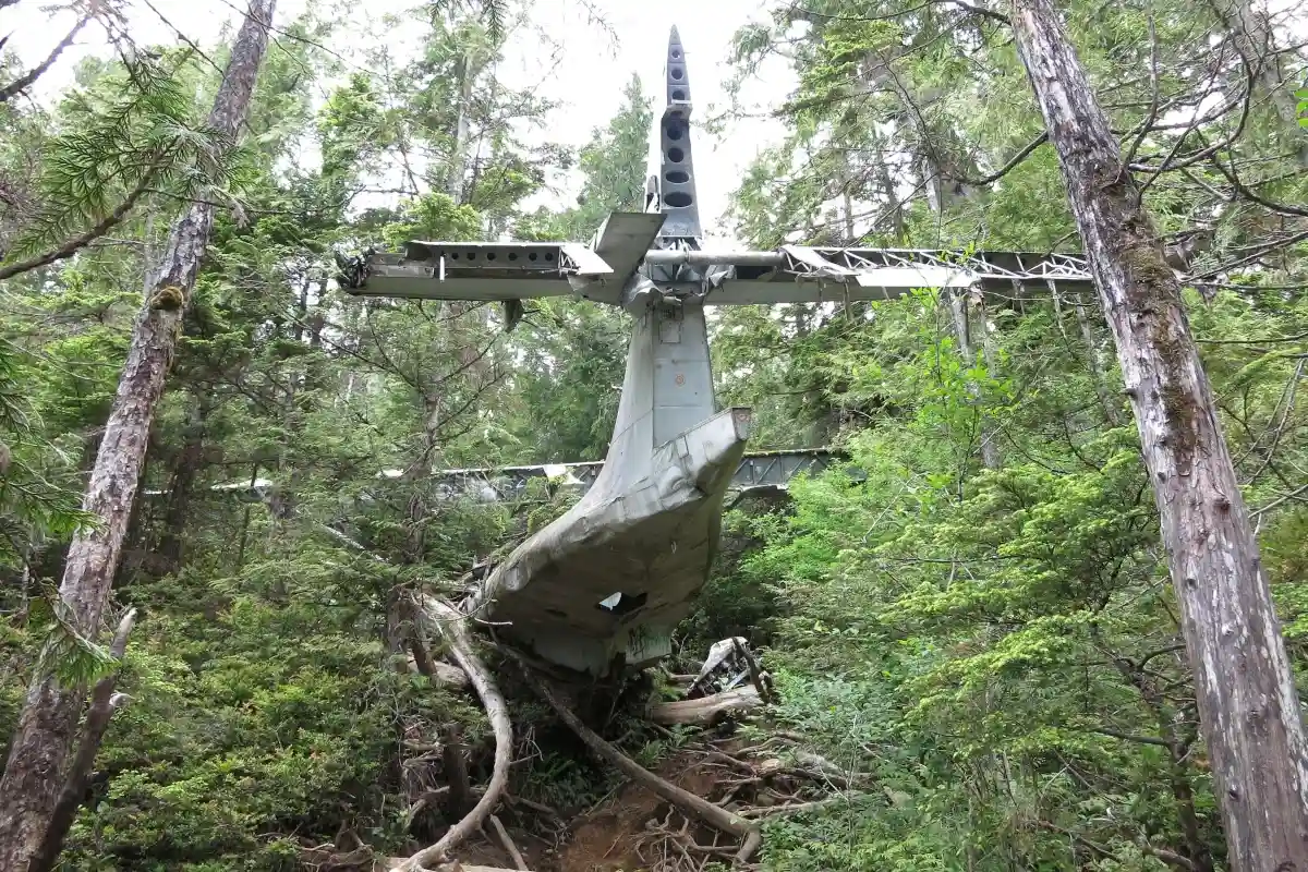
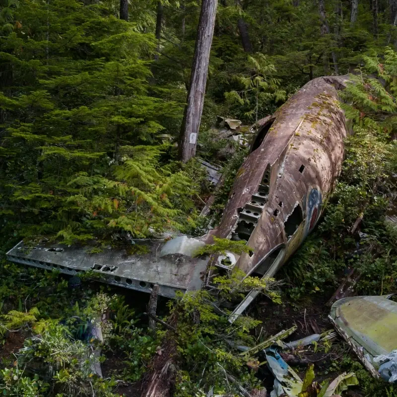
Mt. Slesse (Selísi) Memorial – Chilliwack
Canadair C-4M2 North Star, 9 Dec 1956
Trans-Canada Airlines Flight 810-9 was en route to Calgary from Vancouver when it crashed into Mt. Slesse (Selísi), killing all 62 on board. The wreckage was discovered the following May, and due to the difficulty of the recovery effort, the area was declared a protected memorial site. It was one of Canada’s worst aviation disasters.
Today, you can hike to the memorial plaque and wreckage via a rugged, 14 km return trail with a 970 m climb. Access is via Chilliwack South FSR.
Stoyoma Crash – Merritt
Conair Douglas A-26C Invader, 12 Aug 1974
While en route from Abbotsford to a firefighting base in Williams Lake, the water bomber, fully loaded with fire retardant, crashed into Stoyoma Mountain near Merritt, killing the pilot. The company, Conair Aviation, lost two other planes the same week.
The trail to this crash site starts at Cabin Lake, which can only be reached with a high-clearance 4×4 vehicle. From there, it’s a 5 km hike to the crash site.
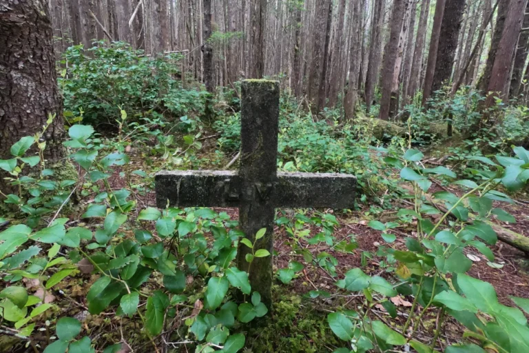
Old Glory B-25 – Rossland
RCAF North American B-25 Mitchell F10, 18 Oct 1947
This photo reconnaissance bomber was flying from Calgary to Penticton when it went missing in poor weather, which included wind, fog, and snow. Despite an extensive search, the wreck was not discovered until 1952. All 9 occupants of the plane were killed, including 7 RCAF crew members and 2 civilians. Due to the condition of the wreck, it is thought that it exploded upon impact.
To reach this hike, take the Old Glory Trail. The coordinates of the wreck are reportedly at 49.167474°N 117.882076°W. Wreckage and a memorial cross can be seen along the trail.
Backcountry Crash Sites
Backcountry experience and off-trail navigation is required to access these sites. Go at your own risk. Always leave a trip plan, pack your ten essentials, and know your abilities before embarking on an off-trail adventure. Check out this article for more on how to navigate forest service roads safely.
Note: The coordinates listed in this article have been sourced from publicly available information online and may not be exact or accurate. Always do your own research before heading out, and be sure you’re prepared for backcountry conditions.
Liberator Crash – Bamfield
Consolidated Liberator GR Mk VIII, 13 July 1945
After taking off on a training flight from Patricia Bay with a crew of 7, the plane made several stops, picking up 6 more airmen and women along the way. It crashed into an unnamed mountain in the Somerset Range after taking off from Tofino, killing all 14 on board.
Coordinates: 48°47’33.9″N 124°59’38.9″W.
Flora Lake Crash – Nitinat
Consolidated B-24 Liberator, 10 Nov 1944
After departing from Abbotsford on a training mission, this B-24 Liberator crashed into the mountainside near Flora Lake, Vancouver Island. All 10 RCAF crew members were killed. Though a search for the wreck was conducted, the crash site wasn’t located until a year later.
Coordinates: N48° 52.879′ W124° 42.444′.
Mt Whymper B-25 – Lake Cowichan
North American Mitchell II B-25, 29 May 1944
This plane disappeared after departing from Boundary Bay on a cross-country training flight. It was later found to have exploded after flying into the side of the mountain. All five on board were killed.
Coordinates: N48° 58.5′ W124° 11.5 (wreck site); 48°56’00.0″N 124°11’00.0″W (burial site).
Okanagan Mountain DC-3 – Penticton
Douglas C-47A-20-DK (DC-3), 22 Dec 1950
This passenger plane was approaching Penticton airport for landing when it crashed on Okanagan Mountain. The crash was the plane being at too low an altitude. The pilot perished in the crash, and the co-pilot later succumbed to his injuries. The remaining 15 passengers and a stewardess survived, but were stranded on the mountain for over a day as rescuers made their way to them.
Coordinates: N 49°43.553′ W 119°35.130′.