Real Honest Trip Reports: The Golden Ears Goat Trail
If you’ve ever thought to yourself, hmm, I’d like my butt absolutely whipped by a hike today, then the Golden Ears Summit Trail is for you. While this trail is classified as difficult, I’d argue that this is too broad a term. This was more like Extra Extra Crazy Hard. I’ve been on plenty of hard trails. Heck, I’ve done the West Coast Trail twice, solo, and parts of that felt like boot camp. The Golden Ears Trail gave me an absolute thrashing.
Trail Information
Length: 24 kilometres round trip
Type: Long day hike or overnighter
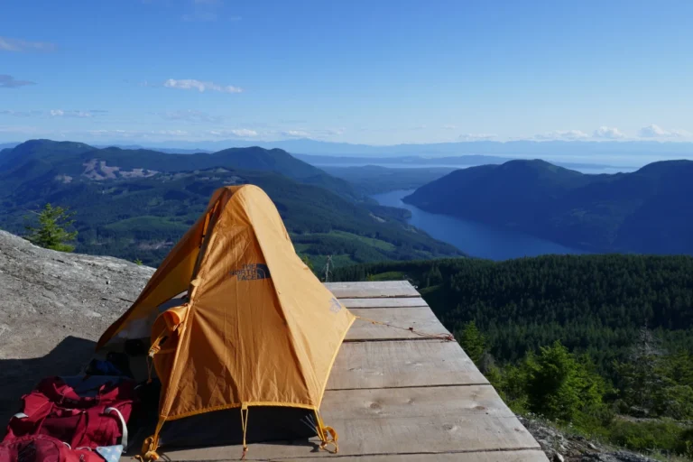
Campsite: Panorama Ridge has 7 tent pads, a bear cache, and pit toilets; Alder Flats has multiple camping spots, a bear cache, and pit toilets. Cost is $5 per person per night.
Route: Take the East or West Canyon Trail to Alder Flats, then follow the Golden Ears Trail
Altitude Gain: 1500 metres
Good for Fear of Heights: No
Now, as a disclaimer, I’m not a fan of the trails in Golden Ears Park due to their condition. This isn’t entirely the fault of BC Parks (although I do have doubts about whether they even own any chainsaws.) The substrate in the area means that erosion turns any trail into what resembles a creek bed full of loose rocks. At one time, for example, the West Canyon Trail had extensive maintenance done on it, but within a year or two it was right back to looking like a rooty, rocky mess. High traffic on the trails certainly isn’t helping, nor is the lack of any new trails built to accommodate the increase in users.
I started my day on the flatter East Canyon Trail, which allowed me to save my energy for the uphill parts of the journey. Hikers can also take the more rugged West Canyon Trail, but be warned that as of 2025, its bridges are damaged or missing due to a winter storm event. (Some may remember the old days when navigating the creeks on that trail involved climbing down the slopes using a rope. Good times.)
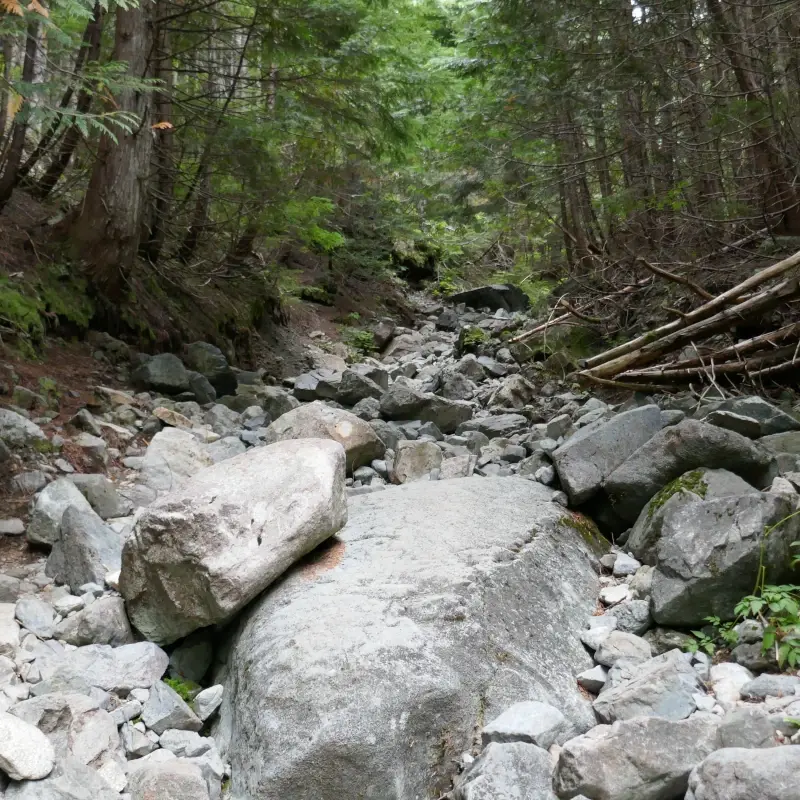
The uphill begins after crossing the bridge linking the East and West Canyon trails. The trail to Alder Flats is pretty straightforward and has some very nice new footbridges on it. After this, you’ll follow an old logging road full of loose rocks and boulders that is really terrible if you’re like me and turn your ankles over all the time. There are a couple of viewpoints along this road that are a perfectly decent destination on their own.
Then the craziness begins. The trail takes a hard right off the old road and starts going up. This begins with a climb up an embankment to a set of not-very-useful waist-high steps. (After you figure out a way to climb up onto the steps, they do become more useful.)
As the trail winds its way upwards, the term “trail” becomes a bit of a stretch, because I would argue that this is more of a goat path. Parts of it are like a log-and-rock climbing course LARPing as a trail. Climbing straight up a pile of stumps, roots, and fallen logs might not be a problem for some people, but I’d like to talk a little bit about types of hikers:
The Gazelle:
You’ve probably been passed by a trail gazelle at some point. Trail runners are often gazelles. They’re fresh-faced and casually loping up the trail like they’re on a stroll at the beach.
The Peasant:
The peasant is built for walking slowly over long distances, sometimes carrying heavy loads. You’ve probably passed them, plodding along, red-faced and out of breath. They’ll get there when they get there (but they will get there.)
I’ve always joked that I have peasant legs. By that I mean that I can run just far enough to get away from the English if they’re raiding the village, and no further. Out of curiosity, I did some research, and apparently, there are genetic differences that mean some people will just never be able to run marathons. Despite hiking uphill all the time, eating healthy, taking my vitamins and minerals, and taking up trail running for an entire year, I’ve never been able to run more than a kilometre.
As such, I was red-faced, out of breath, and feeling a bit like Frodo Baggins climbing Mt. Doom as I made my way up the trail. I was passed by a gazelle or two on the way, which made me feel pretty bad about myself, but I was also happy to see another tomato-faced peasant later on the way back down.
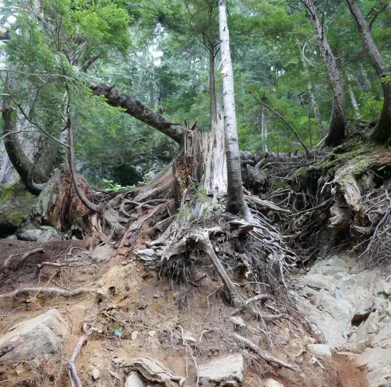
The trail is rough. Expect to be finding a way to climb up rock, roots, stumps, root balls, and loose dirt. It’s especially tough if you have short legs like me. Some spots are absolutely ridiculous, but in all fairness, if I were parks staff, I wouldn’t want to haul a chainsaw or tools all the way up there either. Take care to find the right foot and handholds, especially on the way back down. Also, be mindful of following the trail markers, because there are a few areas that look like the trail but are not.
One thing to remember about climbing mountains: there is always, always a false summit. On this trail, there are several of them. If you think to yourself, yes, I’m finally close to the top, you are wrong. You are not close to the top. Sorry.
As you gain elevation, you’ll notice large yellow cedars as you enter old-growth forest. In the autumn, you should see squirrels busily harvesting fir cones to eat and store for winter. You might even get scolded by one. Don’t steal their cones because they don’t like it. Birds are also in abundance, especially if the alpine blueberries are ripe. The forest is lovely and smells really nice.
Please don’t carve your initials into the trees like some people do. To the people who do this: you aren’t outdoorspeople. You can’t sit with us. Go back to Walmart and carve into the walls there. Take your scattered toilet paper and dog poop bags with you.
Eventually, after several rounds of climbing and flattening out, you’ll come to a short ladder. Why there’s a single random ladder way up the mountain and not anywhere else on the trail is beyond me, because it seems like they could use a few more of them. The ten-kilometre marker is here, but take that number with a grain of salt, as BC Parks distances are notoriously inaccurate.
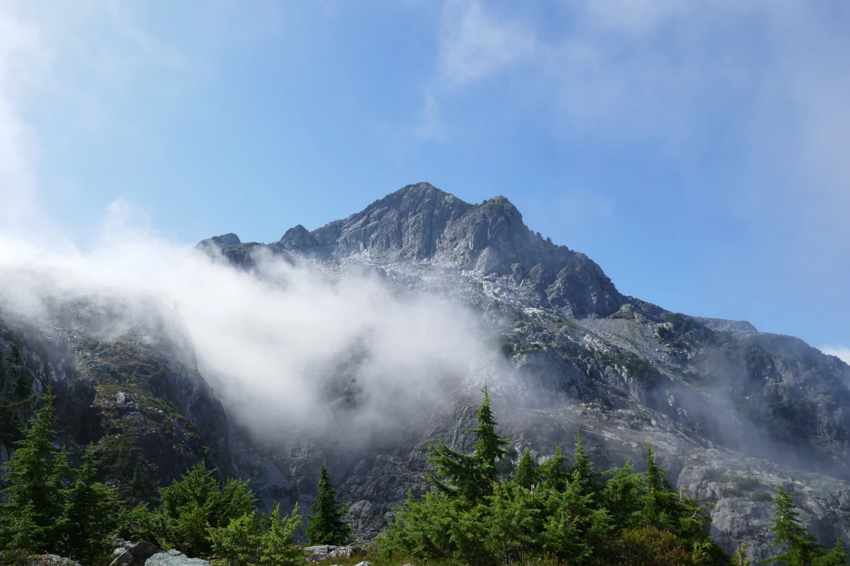
You’re now close to the top, and the trail winds over bare rock with scattered trees. At first, I was excited to find alpine blueberries, but was devastated to find that they were already at the end of their season. It was cloudy, so I didn’t see much of a view, but I expect there are some spectacular panoramas at this point. Even without a view, the feeling of being atop a mountain is a big accomplishment. The clouds rolling over the rock gave it a moody, mysterious feel.
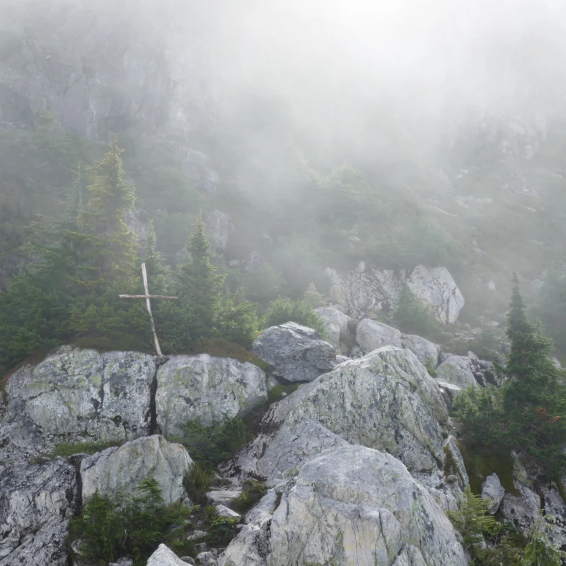
The final push to Panorama Ridge and the summit involves following the trail over a rocky bluff with some exposure. There is a very ominous wooden cross sitting up there that really adds a bit of drama. Though I did attempt to go further, my fear of heights put the brakes on my journey. Panorama Ridge and the emergency shelter are apparently just beyond, but my brain didn’t fancy scrambling up a rock beside a cliff.
Given the small rock cairn that was at the place where I stopped, I wasn’t the only one to turn around there. I felt pretty good about calling it there, because I was pretty darned exhausted, and that was only the halfway mark of the hike. I didn’t think it would do to have tired, sloppy feet while picking my way down. (Though I did turn an ankle over on that rock-filled old road on the way down anyway.)
All told, I didn’t think the trail was worth the hype. Some will argue with me, but in my opinion, there are places where you can get beautiful views with way less effort and better trail conditions. Will I ever try it again? Maybe, if I ever learn how to fly a helicopter.
Golden Ears Trail Rating:
Views: 1/10 (I did get a glimpse of Pitt Lake and the summit.)
Trail Conditions: 1/10 (Need to slap some more ladders on that bad boy.)
Angry Squirrels: 10/10 (Don’t steal their fir cones.)
Overall: 3/10