BC’s Historic Fire Lookout Hikes
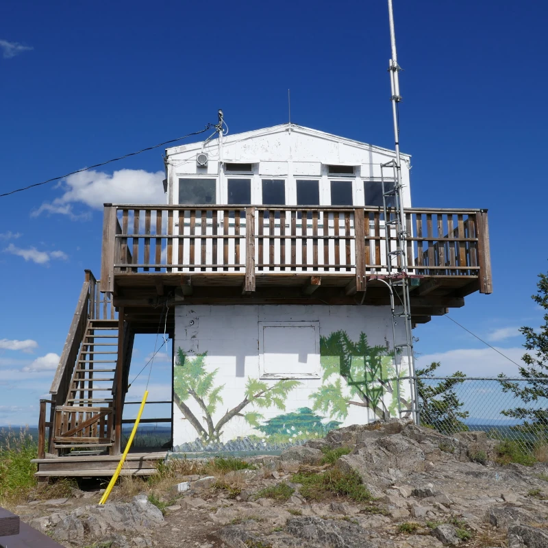
On mountaintops in decades past, an extensive network of fire lookouts and the lookout men stationed within once protected British Columbia’s valuable timber from wildfires. While today there are just two manned fire lookouts, over 300 once existed around the province. Over time, as wildfire detection technology advanced, most of these places were removed or left to the elements to disintegrate.
Less than a hundred are left standing today. Some of these have been restored, rebuilt, and lovingly cared for, while others slowly fade away. Accessing these places can be incredibly difficult, usually requiring high-clearance 4WD vehicles. While there are many hikes to viewpoints where fire lookout towers once stood, finding hikes to the ones that are still standing can be challenging.
The fire lookout hikes covered here are those easily accessible using 2WD vehicles, with minimal navigation on backcountry roads. Basically, you can get to the trailhead in a Toyota Corolla without getting lost.
Etiquette for Visitors
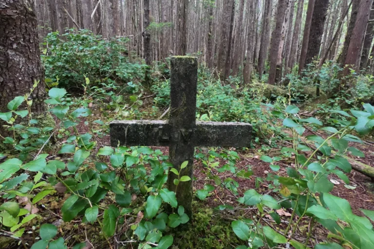
Similar to visiting plane crash sites, fire lookouts should be considered historic sites and be treated with respect. Since most are user-maintained, consider bringing along a garbage bag and collecting any trash left behind. If the lookout is stocked with supplies for overnight stays, ensure that the space is tidy when you leave.
- Practice Leave No Trace principles.
- Be respectful.
- No vandalism, including carving or writing initials.
- No leaving garbage behind.
- Take only photos.
- No looting of historic artifacts.
Southwest BC and the Island
Harrison Fire Lookout Trail
Location: 20 Mile Bay FSR, off Sts’ailes (formerly Harrison West) FSR
Length: (round trip): 3.7 km
Directions: Take Lougheed Highway 7 to Harrison Mills and turn onto Morris Valley Road. Travel along this road until you pass Weaver Creek Spawning Channel on your right. The road turns to gravel and becomes Sts’ailes Forest Service Road (formerly Harrison West FSR). When you reach approximately 25 km, keep left onto 20 Mile Bay FSR and continue approximately 500 m. The trailhead is an old gravel road on the left.
Notes: The surrounding area was burned in a wildfire, so beware of deadfall and dangerous trees. The trail is not maintained and may be overgrown. There is a risk of ticks and chiggers in this area, especially in spring and summer.
More Info
Holdover Peak Fire Lookout / Monument 83 Trail
Location: Manning Provincial Park
Length: (round trip) 30 km
Directions: The parking lot for Manning Park’s Monument 83 Trail is located approximately 3.5 kms east of Gibson Pass Road (Manning Park Lodge) off Crowsnest Highway 3.
Notes: While the two lookouts here are American fire lookout towers, a re-survey of the border placed one of the two buildings within Canada. The Monument 83 Trail has suffered significant damage from wildfires and weather events. Expect blowdown, bridge washouts, overgrowth, and difficult conditions. Backcountry fees apply if staying overnight.
More Info
Mt. Manuel Quimper (Sooke Fire Lookout)
Location: Sooke
Length: (round trip) 10 km
Directions: From Sooke Road (Highway 14), turn onto Harbourview Road and proceed to Sea to Sea Regional Park.
Notes: There is a network of trails in the park. While the most direct route to the fire lookout tower is a 10 km trip out-and-back, it’s also possible to return via other trails, making a loop of approximately the same length.
More Info
Windy Joe Trail (Windy Joe Fire Lookout)
Location: Manning Provincial Park
Length: (round trip) 16 km
Directions: From Crowsnest Highway 3, proceed approximately 1 km down Manning Park’s Gibson Pass Road. Parking is located along the south side of the road at the Windy Joe/PCT Trailhead.
Notes: Expect blowdown on the trail.
More Info
Woss Fire Lookout
Location: Woss
Length: (round trip) 3 km
Directions: From the Woss Junction on Highway 19, continue north for 9.6 kms. Turn right onto Markusen Main. Follow this road for 6.7 kms until you reach a parking lot and kiosk. Continue on foot up the road 1 km to the trailhead.
Notes: The Woss Fire Lookout is closed seasonally from October to May. The trail is steep and difficult.
More Info
Thompson Okanagan
Mt. Roderick Dhu Fire Lookout
Location: Greenwood
Length: (round trip) 11 km
Directions: From Crowsnest Highway 3 north of Greenwood, turn onto Boundary Creek Road. Veer right onto Jewel Lake Road, following signage to Jewel Lake Provincial Park. Trailhead is located directly across from Jewel Lake Ave.
Notes: There is also vehicle access to the summit via forest service roads, but 4WD vehicles are recommended.
More Info
Silver Star Mtn Fire Lookout
Location: Vernon
Length: Varies, <5 km (one way)
Directions: From Highway 97 in Vernon, turn onto 48 Ave, which turns into Silver Star Road. Follow this road up the mountain to Silver Star Ski Resort. From the village, proceed up one of the hiking trails to the top of Des Schumann Gondola, where the fire lookout is located.
Notes: This is a summer hike only. Hiking is free, but if taking the lift, fees will apply.
More Info
Kootenays
Buchanan Fire Lookout (Car Access and Friendly Giant Trail)
Location: Kaslo
Length: 17 km (one way)
Directions (Vehicle): From Kaslo, go west on Highway 31A for 11 km. Turn right onto Blue Ridge Forest Services Road and follow signage. Follow the main road for 11.9 km to the lookout, staying right at the 7.0 km junction. This road is suitable for 2WD vehicles.
Directions (Trail): Accessed via the Moose Meadows day use cabin and parking lot.
Notes: It’s possible to hike or drive up to this fire lookout. Stay off the hang gliding ramps at the top.
More Info (Vehicle) | More Info (Trail)
Mt. Cartier Fire Lookout Trail
Location: Revelstoke
Length: (round trip) 30 km
Directions: From Trans-Canada Highway 1 in Revelstoke, turn onto Victoria Rd. Follow it and turn left onto Fourth St E. Follow this road until it turns into Airport Way. Look for the Mt Cartier Recreation Trail trailhead and parking approximately 10 km down Airport Way on the left side of the road.
Notes: Follows an old horse trail. The trail is officially listed as closed at the 2.5 km mark due to an unstable bridge.
More Info
Idaho Peak Fire Lookout (Wakefield Trail)
Location: Silverton
Length: (round trip) 14 km
Directions: From Silverton, travel down Four Mile Creek FSR for 4.6 kms. Turn left onto a steep, narrow road and drive 3.9 kms to the parking lot.
Notes: The steep and difficult trail is an old pack horse route and remnants of mining operations can be seen along the way.
More Info
Old Glory Fire Lookout Trail
Location: Rossland
Length: (round trip) 18 km
Directions: Head north on Highway 3B from Rossland for approximately 10 kilometres. The trailhead is located on the left side of the highway.
Notes: The mountain was home to the highest weather station in Canada. Only the fire lookout remains, but there are foundations of other old buildings as well. While the lookout is reached via the Old Glory Trail, it’s also possible to reach it via the 9 km (round trip) Plewman Trail, or create a loop using both.
More Info
Paget Peak Lookout
Location: Yoho National Park
Length: (round trip) 7 km
Directions: From Field, travel 13 kilometres along Trans Canada Highway 1 to Lake O’Hara Rd. Turn around and head back 2 km to the Sherbrooke Lake Parking Lot. The parking lot is only accessed westbound.
Notes: Trail is steep and rocky. Visitor fees apply.
More Info
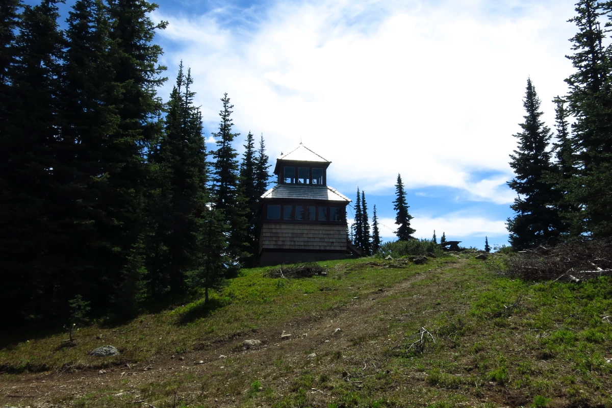
Summit Lookout, Mt. Revelstoke
Location: Mt. Revelstoke National Park
Length: (round trip) 3 km
Directions: From Trans-Canada Highway 1 in Revelstoke, turn onto Meadows in the Sky Parkway and follow it to the Balsam Lake parking area. The fire tower can be reached via a walk up the road or the Upper Summit Trail. It’s another 500 m to the fire lookout.
Notes: Only open during summer months. No dogs allowed. Visitor fees apply.
More Info
Cariboo Chilcotin
Begbie Lookout
Location: 70/100 Mile House
Length: <1 km
Directions: Located just off Cariboo Highway 97, the turnoff is midway (20 km) between 70 Mile House and 20 km south of 100 Mile House. On the east side of the highway, just off Lookout Road, is a small parking lot.
Notes: It’s a short uphill hike to the lookout, but it’s well worth a pit stop.
More Info
Two Sisters Lookout Trail
Location: Wells
Length: (round trip) 12 km
Directions: Follow Highway 26 from Wells to Bowron Lake Rd. Continue on Bowron Lake Rd for approximately 17.5km to West Creek FSR on the left. Trailhead is located on the left side of the road approximately 5 km up.
Notes: Limited parking on the edge of the road. The trail follows an old service road used to access the lookout.
More Info
Northern BC
McBride Peak Fire Lookout
Location: McBride
Length: (round trip) 12 km
Directions: From McBride, travel 2 kilometres east on Yellowhead Highway 16 to Mountainview Rd. Turn right onto Rainbow Falls FSR. 2WD vehicles can travel halfway up and park at the viewpoint. The remaining 6 km of road are hiked to reach the fire lookout.
Notes: Those with a high-clearance 4WD can drive most of the way up to the lookout.
More Info
Tacheeda Lookout Trail
Location: Prince George
Length: (round trip) 11 km
Directions: Travel approximately 85 km north of Prince George on John Hart Highway 97. Turn right onto Redrocky Rd. After approximately 7.7 kilometres, keep left onto Colbourne Rd. The trailhead is located on the right side of the road after approximately 9.5 kms.
Notes: Use extreme caution when travelling the access roads, as they are heavily used by industrial traffic.
More Info
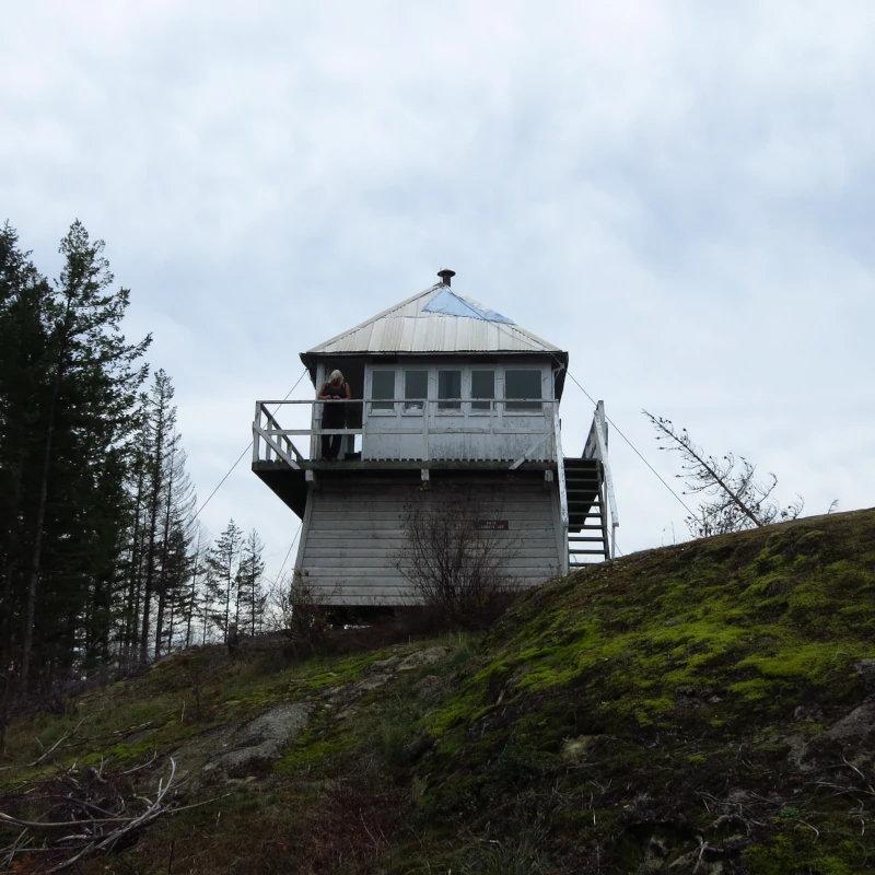
BC Fire Lookouts with Structures Still Standing
The following lookouts are confirmed to have standing structures or are likely to still have unmaintained standing structures as of 2026. For most, access is difficult, usually requiring high clearance 4WD or off-road vehicles.
While some of these are 2WD accessible, they require extensive navigation through active road networks. Others are partially accessible by 2WD and can be walked the remainder of the way; however, hikers should use caution if choosing to be on forest service roads on foot or bicycle.
Visitors should be experienced in self-sufficient backcountry travel and navigating road networks. Extreme caution is recommended while using active resource roads. Check for wildfires in the area if heading out in summer. Research your destination thoroughly and go at your own risk.
Older fire lookouts may be unsafe or inhabited by rodents. Many of these structures are maintained by non-profit organizations. Practise good etiquette when visiting. Please respect volunteer-maintained fire lookouts and leave them tidy so that others may enjoy them.
- Agate Fire Lookout (Princeton)
- Baker Fire Lookout (Cranbrook)
- Baldy Mtn Fire Lookout (Clearwater)
- Battle Mtn Fire Lookout (Wells Gray Provincial Park)
- Beaver Bluff Fire Lookout (Terrace)
- Mt. Bickford Lookout (Chetwynd)
- Bluejoint Mtn Fire Lookout (Granby Provincial Park)
- Botanie Fire Lookout (Lytton)
- Brent Mountain Fire Lookout (Hedley)
- Camelshoof Peak Fire Lookout (Lillooet)
- Carbon Fire Lookout (Chetwynd)
- Casey Fire Lookout / Plumbob Mtn, (Kootenays)
- Chilanko Fire Lookout (Chilanko Forks)
- Cornwall Lookout (Cornwall Hills Provincial Park)
- Crevice Lookout (Corbin)
- Cronin Fire Lookout (Smithers)
- Cummins Fire Lookout (near Kinbasket Lake; unknown if structure still standing; access difficult)
- Eureka Fire Lookout (Cherryville)
- Gibraltar Lookout Trail (Canal Flats)
- Greenstone Fire Lookout (Kamloops)
- Goat Peak Fire Lookout (Beaverdell)
- Mount Hallowell Fire Lookout (Spipiyus Provincial Park, Sunshine Coast)
- Hamilton Fire Lookout (Merritt area, surrounded by private property, no public access)
- Hankin Fire Lookout (Smithers; the Bulkley Backcountry Ski Society rents out this lookout for a fee)
- Jesmond Fire Lookout (Clinton)
- Joss Mountain Lookout (Revelstoke)
- Jubilee Mountain Fire Lookout (Golden)
- Lakit (Wildhorse) Lookout (Cranbrook)
- Lemon / Skycastle Fire Lookout (Slocan)
- Mara Mountain Lookout on Morton Peak (Sicamous)
- Mobley (Crowfoot Mountain) Fire Lookout (Celista)
- Owen Hill Lookout (Houston)
- Phoenix Knob Hill (Greenwood; currently in use for storage)
- Puggins Mountain Fire Lookout (Dawson Creek)
- Saddle Mountain Lookout (Nakusp)
- Skookumchuck Lookout (Skookumchuck)
- Sproat Mountain Lookout Trail (Revelstoke)
- Story Lookout (Houston)
- Sugar Mountain Lookout (Cherryville)
- Thunder Mountain Lookout (Tumbler Ridge)
- Thornhill Lookout (Terrace)
- Vavenby Mountain Lookout (Vavenby)
- Verdun Lookout (Burns Lake)
Fire Lookout Restoration Projects
The Four Wheel Drive Association of BC is planning to restore two lookouts that have been burned in wildfires in recent years:
- Nahatlatch Fire Lookout
- Lavina Fire Lookout
If you’d like to support these projects, consider donating to help restore them.